ADDRESS PLANNING
FATİH MUNICIPALITY & KHAS SURVEY PROJECTS
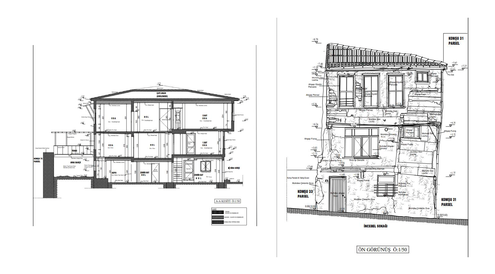
In the first phase of the project, which has been carried out jointly by Istanbul Fatih Municipality and Kadir Has University since 2022, it is aimed to take the relief of 70 buildings in total. These structures determined by the municipality are uploaded to the database, and a study was initiated to ensure that no area in the region has data about the building and to create an address planning database.
Three-dimensional scanning of all the buildings identified before the survey work was carried out in this region. Three-dimensional scanning can be considered as an x-ray of the building. It enables the reveal of the structures with all their details. Afterward, by going to the island parcel where each scanned building is located, one by one, the survey is taken and added to the Municipality database. Of the 70 surveys on our list, 39 have been completed, and the works for the remaining islands and parcels are still in progress.
In case of any disaster, when the buildings are damaged, demolished, etc., to access the history of the building on that island parcel, the building survey must be taken in public institutions, so this work we carry out for the missing surveys is critical.
On 2 August 2023, in the evaluation meeting on "Surveying, Restitution and Restoration Studies of Immovable Cultural Heritage in Istanbul Province" held under the chairmanship of Istanbul Governor Davut GÜL in the meeting hall of Istanbul Governorship AFAD, Fatih Mayor Mehmet Ergün Turan mentioned the surveying studies we carried out and said that it is the first university among universities to undertake such a project.

URBAN DATA DASHBOARD
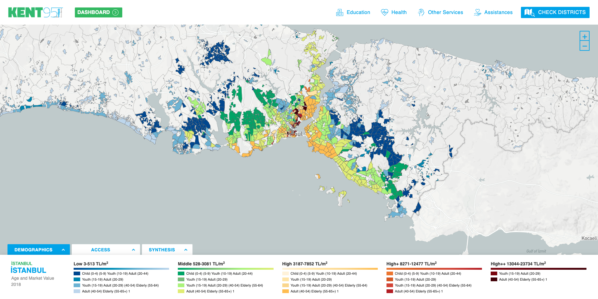
Kadir Has University Istanbul Studies Center is the partner of the project Empowering Civil Society and Municipalities for Data-Driven Participatory Gender Equality Policies conducted by the Turkish Economic and Social Studies Foundation (TESEV). The project aims to provide accessible data on gender inequalities and their distribution at the neighborhood level in İzmir and Balıkesir and to highlight the importance of data-driven decision-making by visualizing this data on an interactive platform. By doing so, the project aims to increase the advocacy activities of civil society organizations by strengthening the cooperation between CSOs and local governments. Access to spatial and urban evidence will allow women’s CSOs to present new, diversified, and tangible demands for urban governance based on gender equality to municipalities and other public institutions. Women’s CSOs will find opportunities for informed participation and advocacy for gender equality.
Within the scope of the project, gender-sensitive neighborhood-level datasets were prepared for both project cities. Data on average household size, marital status, education, population density, preschool education, health, and access to public transportation services were gathered, and thematic and synthesis maps were prepared for monitoring gender inequalities by geographic distribution. For more information, please visit: https://map.kent95.org/#